Bolivia - Maps and pictures of the Pampas
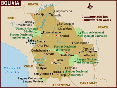 Hey kids!! Barb is going to use her fantastic writing skillz to fill you in on our trip to the Pampas, but I thought I would upload some pictures since it always takes forever to do so. Here is a map of Bolivia so you can follow along if you´d like. We crossed the border around Lake Titikaka, headed to Copacabana, then to La Paz. We flew to Rurrenabaque for the Pampas trip (very scary flight, with lightning flashing outside of our window when we were in the air, Phil´s
  arm was probably tingly because of my amazing grip on it), then yesterday we flew back to La Paz. We are taking an overnight bus to Sucre (dinosaur footprints!!) tonight, then going to Potosi (the world´s highest town), then to the Salar de Uyini to do a 3 day tour of the Salt Plains which lets us off right down by Laguna Verde so we can c
 ross into Chile. From there, Barb and I set off in different directions, Barb is going down through Chile and we´re going right over to Argentina to check a few things out.
Okay, picture time! We saw heaps of wicked animals in the Pampas. First off is my personal favorite, the capybara. They are about 1 m high and are the biggest rodents in the world.
 When we were cruising down the lake, we saw two big ones come tearing out of the woods and dash directly into the water at top speed, about 3 m from our boat. It was awesome. We saw heaps of aligators (we even went on a night cruise where you can see hundreds of their eyes reflecting the light off the flashlights) and loads of different birds. We saw a tree full of spider mon
 keys and had a group of howler monkeys sit in a tree directly above our bathrooms and howl for about half an hour. Anyway, it was a wicked trip and well worth the state of complete ming we were in when we got back.
posted by Andrea MacRae at
9:33 a.m.
![]()

0 Comments:
Post a Comment
<< Home